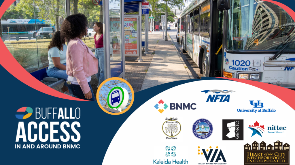
Buffalo All Access
Improving transit options for everyone in and around the Buffalo Niagara Medical Campus.
Complete Trip Platform (CTP)
A mobile app, website, and call center that gives you real-time transit schedules and helps you plan your trip and receive navigation assistance based on your unique needs and abilities.
Community Shuttle Service
A free and on-demand shuttle system will circulate around the Fruit Belt, medical campus, and Masten Park areas, providing door-to-door service.
Smart Infrastructure
Wayfinding technologies outdoors on the medical campus and indoors at VIA and Buffalo General will assist travelers needing support.
What Does it Mean for You?
Buffalo All Access is a new initiative that will use technology to improve transportation options for all travelers in and around the Buffalo Niagara Medical Campus (BNMC).
It will make it easier to use public transit and access essential services and destinations around the area, particularly for anyone with disabilities and their caregivers.
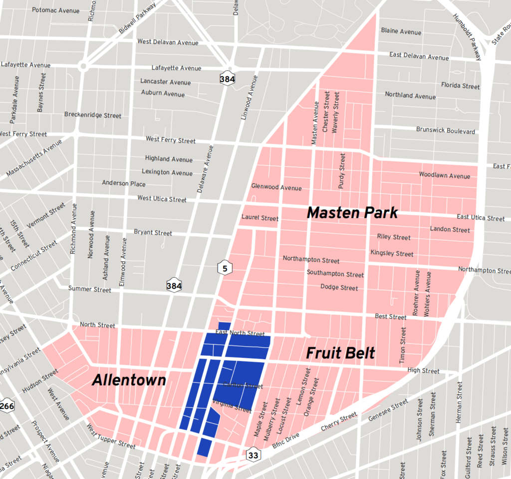
Location
Buffalo All Access will provide inclusive trip planning and travel options for the WNY community with a focus on the medical campus, Allentown, Fruit Belt, and Masten Park neighborhoods.
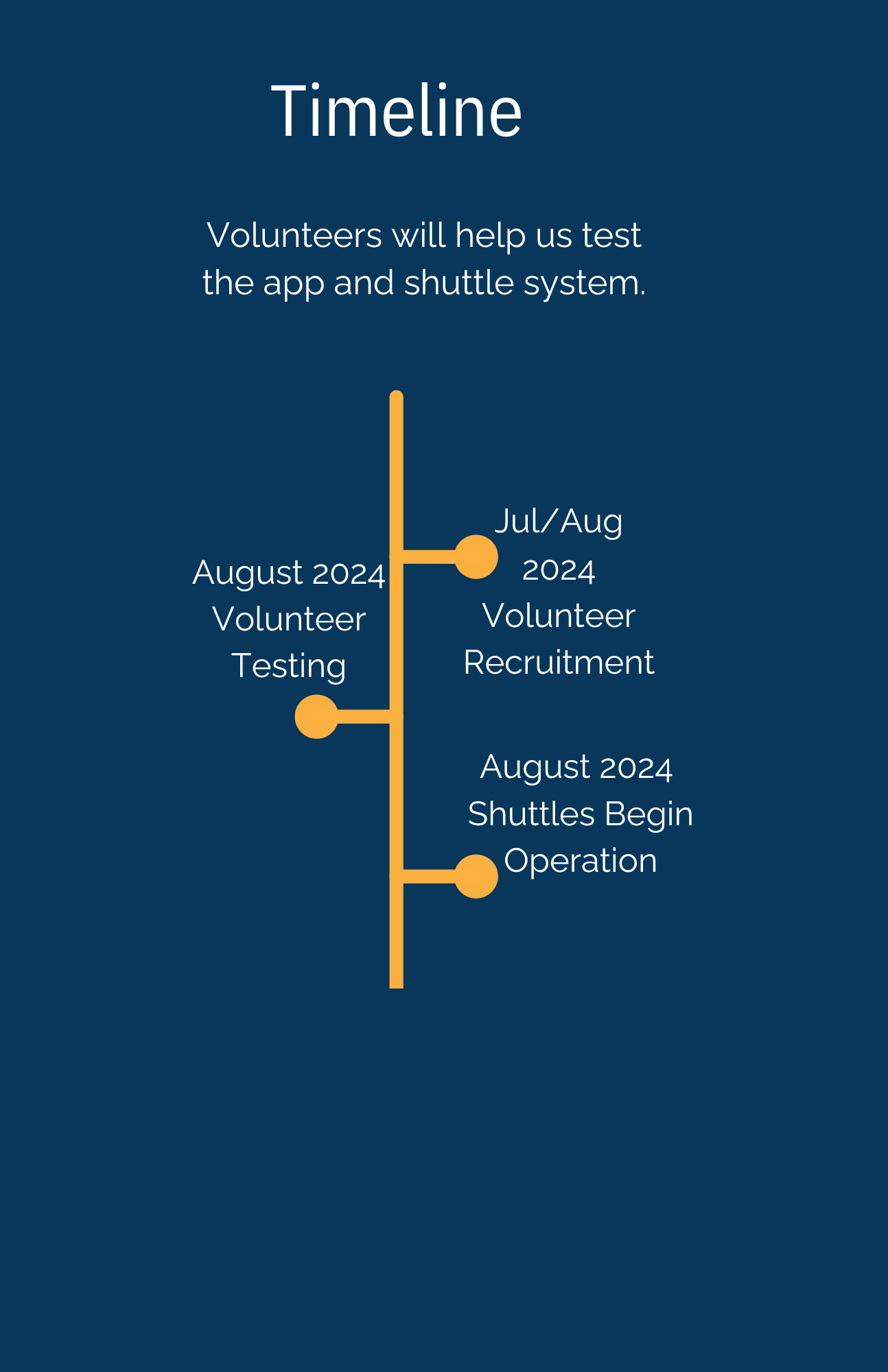
Join Our Study!
We are conducting research led by the University at Buffalo to evaluate the new technologies we have recently implemented in and around the BNMC.
You will be asked to use and give your feedback on them. Every eligible person who completes 4 surveys over an 18-month period can enter a drawing to win up to $500. To participate you must:
- Be 18 years of age or older.
- Travel to/from the Fruit Belt, Medical Campus, or surrounding area.
This research has been reviewed and approved by an Institutional Review Board (“IRB”). An IRB is a committee that provides ethical and regulatory oversight of research that involves human subjects.
Here’s How To Get Involved.
Download the Buffalo All Access App & register! We will send you a survey to participate.
Choose one of the following options:
- Email xxx@xxx.
- Call (716) 888-4600.
- Visit this link.
Or, click below to visit the App Store and download the App.
Webinars
The Buffalo All Access team regularly hosts informational webinars about the project.
Please check back with us for details and registration for our next event.
Connect with us on Social Media
Contact Us
If you have a question or comment or, are interested in getting involved, contact us using the form below.